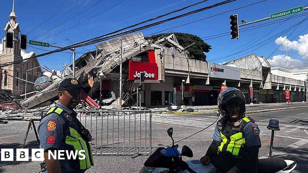
A 7.8-magnitude earthquake struck southern Philippines, killing at least 19 people and damaging key infrastructure, including buildings and a popular hamburger joint in the city of General Santos. The quake. Which occurred off the coast of Mindanao at a depth of 20 miles, caused landslides and tsunami damage in coastal areas, according to the Philippine Institute of Volcanology and Seismology.
Earthquake Details and Aftermath
The Pacific Tsunami Warning Center said the threat of a tsunami largely passed about five hours after the quake — However, six shanties on stilts were damaged in a coastal village in Zamboanga del Sur due to the taller waves, officials said. General Santos. A port city of more than 700,000 people, was among the hardest hit — At least seven of the dead were in the city, where a few small buildings collapsed or were severely damaged.
The earthquake struck at 7.37am local time and was centered 8 miles southwest of General Santos City, according to the Philippine Institute of Volcanology and Seismology. The U.S. Geological Survey reported a depth of 34 miles; Power outages were reported in the region, and residents in Indonesia’s North Sulawesi and North Maluku provinces also felt the tremors.
Government Response and Evacuations
Philippine President Ferdinand Marcos Jr. announced that the national government is moving to assist affected areas and stated, “We will not leave Mindanao behind.” Evacuation centers were already operational, and government agencies were assessing damage and clearing routes for rescue operations. The president also ordered the suspension of schools in the affected areas until further notice.
According to the Office of Civil Defense, the deaths were caused by falling debris, a damaged mosque, and a landslide in the southern provinces of Sarangani, South Cotabato, and Davao Occidental. The Philippines Red Cross reported attending three high schools to support students traumatized by the quake, as the event occurred during the first day of the new academic year.
Seismic and Regional Context
The Philippines is located on the Pacific “Ring of Fire,” a seismically active zone that makes the country prone to earthquakes and volcanic eruptions; the archipelago also experiences about 20 typhoons and tropical storms annually. The quake’s timing. Occurring as schools reopened, added to the disruption and anxiety among residents.
The Pacific Tsunami Warning Center initially warned of possible tsunami waves up to 3 meters in some parts of the Philippines and up to 1 meter in Indonesia and Malaysia. In a later update, the center said the threat had largely passed. General Santos. A key hub for tuna exports and commerce, sustained damage to its infrastructure, which could impact local and national trade in the coming weeks.
Residents and officials continue to monitor the situation, with efforts focused on search and rescue, infrastructure repair, and long-term recovery planning. The government emphasized its commitment to supporting affected communities as the region works to rebuild in the aftermath of the disaster.


Comments
No comments yet
Be the first to share your thoughts