Residents of Maryland are experiencing unseasonably warm temperatures, with the potential for record highs in parts of the state before a sudden and dramatic shift in weather brings the threat of severe thunderstorms and a sharp drop in temperatures.
Warmth and Record Potential
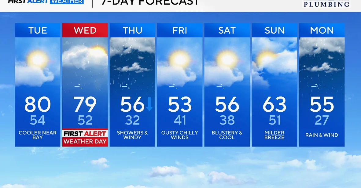
Record high temperatures are possible in Baltimore on Tuesday and Wednesday afternoons, according to the WJZ First Alert Weather Team. The forecast shows high temperatures approaching 80 degrees at BWI Marshall on Tuesday, matching the record set in 2016, and 79 degrees on Wednesday, which was recorded in 2021.
However, areas along and near the Chesapeake Bay are expected to remain cooler, with high temperatures staying in the 60s due to the influence of a chilly wind coming off the water.
Severe Weather Threat
A powerful cold front is set to move through Maryland on Wednesday, bringing with it clusters of showers and the potential for severe thunderstorms. The WJZ First Alert Weather Team has upgraded Wednesday to a First Alert Weather Day, highlighting the risk of damaging wind gusts up to 60 mph, hail, and isolated tornadoes.
The greatest tornado risk is expected just west of the WJZ viewing area, but the team will continue monitoring for possible stray tornadoes in the region. In addition to the severe weather, torrential downpours could impact the evening commute, causing travel delays in some areas.
The chance of storms will increase by early afternoon and peak between 3 p.m. and 9 p.m. Temperatures will drop by 25 to 30 degrees Wednesday night as colder air arrives behind the cold front.
Temperature Swings and Winter Outlook
By Thursday morning, temperatures will drop from the mid-50s into the middle 40s, with showers and breezy winds expected. A few sleet pellets or snowflakes could mix with light rain later in the day.
Friday will bring dry, breezy, and chilly conditions, with temperatures peaking in the low to mid-50s. Similar weather is expected on Saturday, followed by slightly warmer conditions on Sunday ahead of another strong front.
Monday will see steady rain and gusty winds, with temperatures plummeting from the mid-50s into the 20s by Monday night. The cold spell is expected to continue through the middle of next week.
There are indications in the weather pattern that could allow a storm to develop around St. Patrick’s Day. While not all models agree on the track and strength of this storm, if it materializes, some wintry weather is possible.
The WJZ First Alert Weather Team urges residents to stay tuned for updates throughout the week as the region faces significant temperature swings and potential severe weather events.


Comments
No comments yet
Be the first to share your thoughts