

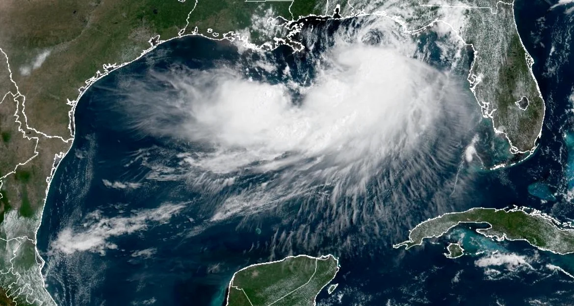
Tropical Storm Bertha made its second landfall on the Gulf Coast near Lake Charles, Louisiana, on Thursday afternoon, moving ashore as it continued its westward path toward Texas. The storm. Which formed into a tropical storm on Sunday, first made landfall around 3 p.m. ET on Wednesday in St. Bernard Parish. Louisiana, about 40 miles east of downtown New Orleans, according to the National Hurricane Center.
Path and Impact
Bertha, packing 45 mph winds, made landfall on Thursday afternoon near Lake Charles and continued west across Texas, heading in the direction of Houston. According to ABC News. Heavy rain from Bertha will continue to move into the Texas coastline from Corpus Christi to Port Lavaca, though most of the storm’s precipitation was displaced to its south in the Gulf. Isolated flash flooding is possible for the Texas coastline.
El Debate reports that Bertha was moving toward the oeste with winds of up to 75 kilometers per hour when it touched down in the south of Louisiana on Wednesday. At that time, its strongest winds and intense rains remained over the sea. The storm is expected to continue to move inland into Texas on Thursday evening and quickly weaken, likely dissipating on Thursday night or Friday morning over Central Texas.
Future Outlook and Risks
Swells generated by Bertha will continue spreading westward along the northern Gulf Coast over the next few days, likely causing life-threatening surf and rip current conditions. The Corpus Christi area could see the most rain from Bertha, with 1 to 3 inches possible through Friday, according to ABC News.
El Debate adds that the tropical humidity associated with Bertha will contribute to a much greater threat of torrential rains and flooding along a cold front affecting the southeast of Virginia, parts of the Carolinas, and the north of Georgia until Thursday. The storm is expected to weaken as it advances slowly toward the west, reaching the Texas coast for the afternoon of Thursday — Bertha will bring rain and possibly gusts of wind to that area, while continuing to send tropical humidity toward storms in the southeast.
Season Context and Rainfall
Bertha is the second named storm of the Atlantic hurricane season, which has had a slow start compared to recent years due to the increasing influence of El Niño over parts of the basin. According to El Debate, more rain is expected until Friday, and some areas could accumulate the amount of rainfall of a month in just a few days.
After dumping rain on the Louisiana coast, Bertha curled back out into the Gulf, where it regained some of its strength before coming back ashore on Thursday afternoon. The storm’s movement and impact highlight the unpredictable nature of tropical systems, which can shift rapidly and bring varied effects to different regions.






Comments
No comments yet
Be the first to share your thoughts