

 BBC
BBC 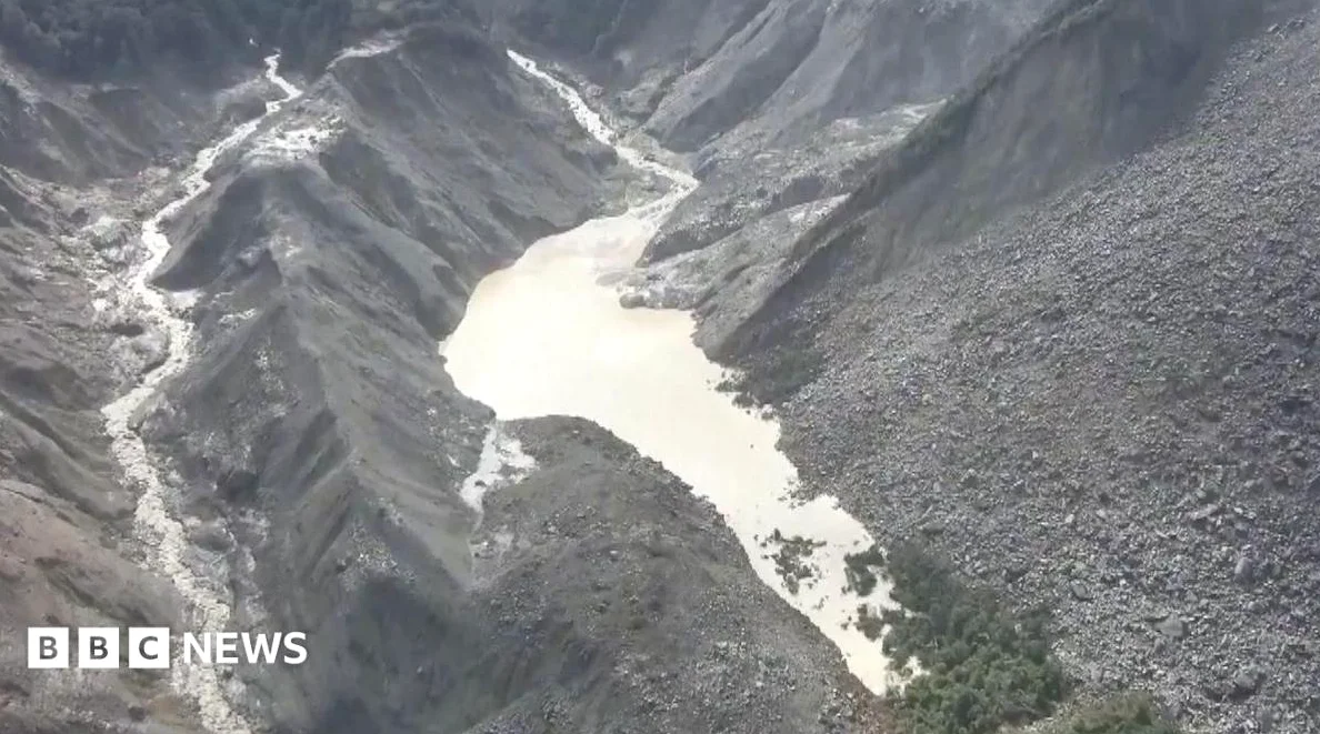
Rescue and monitoring efforts are underway in the Nepal-Tibet border region after a glacial collapse triggered a deadly flood on Wednesday. Chinese state media has reported significant casualties, while Nepalese officials described the impact as a “huge scale loss.” The disaster, initially thought to be earthquake-related, was later confirmed by the U.S. Geological Survey (USGS) to be caused by a “glacial collapse,” where a glacier or part of a glacier disintegrated with such force that it registered a magnitude of 5.2.
What Caused the Landslide and Flooding?
Mike Searle, a professor of Earth sciences at Oxford University, explained to the BBC that the glacier may have collapsed hours or days before the flood hit. He suggested that a landslide first occurred, which led to water building up and damming the river before it burst in a “huge great flood.” The deluge of material swept through northern Nepalese towns, including areas popular with tourists and pilgrims.
Risk of a Second Flood
On Friday, an estimated 2.5 million cubic metres of water had already accumulated in the barrier lake, according to Chinese broadcaster CCTV. Officials warned that up to three million more cubic metres of water could flow into the lake between Thursday and the weekend, raising a “high risk of breach.” The lake, formed when debris dammed the Chhochen Khola and Purepu Tsangpo rivers, is located near the Langtang Lirung peak, where the collapsed glacier is believed to have originated.
A Chinese military drone recorded an avalanche on Friday morning, depositing an estimated 50,000 cubic metres of ice debris into the barrier lake — In response, authorities issued warnings and prepared for emergency evacuations. Rescue operations were temporarily suspended as the lake overflowed non-stop, raising fears of fresh floods or debris flows.
Rescue Operations and Monitoring
By Friday afternoon, Chinese state media reported that the “risk from the upstream barrier lake had come under control,” and rescue operations resumed, as Engineering teams were dispatched to monitor water levels and atmospheric conditions, while drones were used to deliver equipment and supplies to affected areas. The barrier lake is located several kilometers upstream from Gyirong Port, a major land crossing linking Nepal and China that was severely impacted by the initial flood on Wednesday.
Experts told the BBC that the lake may naturally drain over time, but the immediate threat remains a concern. The border region, around 40 miles north of Kathmandu, continues to face challenges as both Chinese and Nepalese officials work to manage the aftermath of the disaster.






Comments
No comments yet
Be the first to share your thoughts