

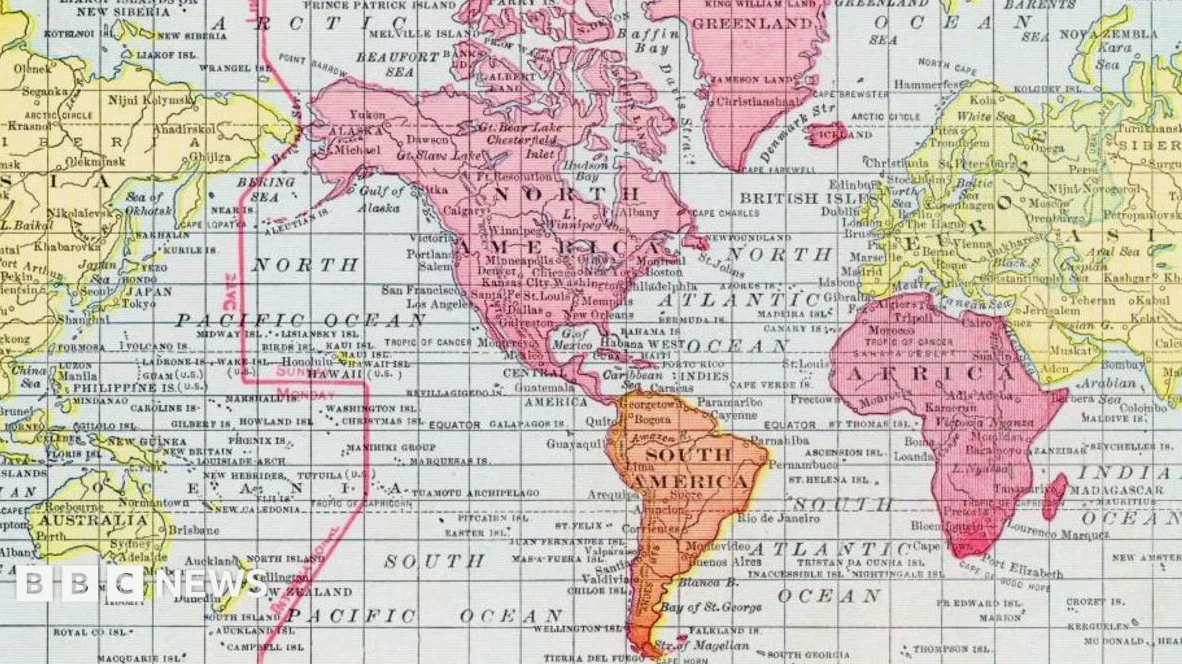
Mercator’s 16th-century map, designed to ensure that a straight line on a map corresponds to a straight line on the globe, remains widely used today; this projection, which stretches the grid lines away from the equator, makes countries near the poles appear larger and those near the equator smaller. According to the BBC, this distortion is a necessary compromise due to the difficulty of representing a spherical Earth on a flat map.
The Psychological Impact of Map Projections
Critics argue that this visual distortion has a psychological effect; Kenyan geographer Kioko Muendo notes that such representations can downplay Africa’s significance in political and economic contexts. “Maps are more than just guides for travellers,they shape how regions are perceived politically and economically,” he told the BBC, this has led to the development of alternative maps like the Equal Earth map, which aims to correct these visual imbalances.
Equal Earth Map: A More Balanced Perspective
The Equal Earth map, developed in 2018 by a team of cartographers, was adopted by African Union members in February — According to the BBC, it presents the size and shape of landmasses more accurately than the Mercator projection. Inspired by the 1963 Robinson projection, the Equal Earth map is an effort to provide a more balanced visual representation of the world.
Maps and Navigation: The Role of AI
Maps are not only used for geographical understanding but also for critical navigation purposes; According to a report from TradingView, the U.S; Navy and other commercial vessels rely on accurate charts and maps for safe navigation. Nick Cooper, a Quality Assurance Manager at Leidos, explained that the volume of maritime data is growing rapidly and traditional methods of data entry are becoming impractical.
To address this, Leidos developed RAVe, an AI-enabled geospatial intelligence software that converts complex imagery into geo-referenced data. This tool automates the process of identifying and attributing features on nautical charts, a task that was previously done manually and was both time-consuming and cognitively demanding.
As the world continues to evolve, so too do the tools and methods used to represent it. From the Mercator projection to the Equal Earth map and AI-driven navigation systems, the way we understand and interact with the world through maps is constantly changing.





Comments
No comments yet
Be the first to share your thoughts